
4G/5G Coverage at Sea
Three physical factors that determine cellular connectivity on yachts, ferries and commercial ships: reflection from the water, the radio horizon and atmospheric ducting.
Antennas in Maritime Applications: Three Key Points
4G/5G coverage at sea depends on physical conditions that are different from land scenarios and unique to the marine environment. On vessels such as yachts, ferries and commercial ships, there are no obstacles like buildings in the way of communication and navigation. Instead, there is the reflective surface of the water, the horizon (the Earth's curvature) and a platform that is constantly moving and rolling.
On this page you will find these three factors, the effect of antenna height on range, and what to look for when choosing an antenna for use at sea.
1Reflection from Water (Multipath) and Fading
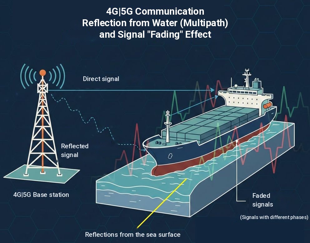
The sea surface acts like a mirror for cellular and GNSS signals. The signal arriving directly from the base station and the signal reflected off the sea surface reach the antenna over different paths.
When the two signals meet at the antenna in opposite phase, they weaken each other. Because of this destructive interference, the signal can drop suddenly even close to shore; this is called a deep fade.
The points where fading occurs depend on distance, antenna height and frequency. As the boat moves and rises and falls with the waves, the signal level changes continuously.
2Earth's Curvature and the Radio Horizon
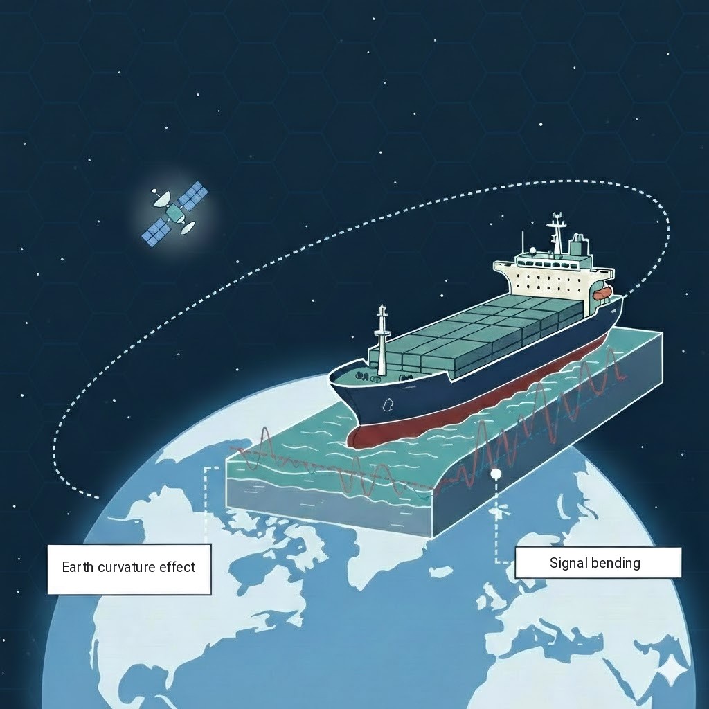
For 4G/5G coverage at sea, the biggest obstacle is not buildings but the Earth's curvature.
Radio horizon: Because radio waves are slightly refracted in the atmosphere, they reach a little beyond the visual horizon. Even so, beyond a certain distance the base station falls below the line of sight (LOS).
Range: The horizon distance increases in proportion to the square root of the antenna height. The higher the antenna, the longer the range.
How Is Range Over Water Calculated?
Line-of-sight range is approximately calculated with this formula:
d: maximum line-of-sight distance · h1: height of the ship's antenna above sea level · h2: height of the base station antenna above sea level. For nautical miles, divide the result by 1.852.
Range Calculator
Worked example
- Ship antenna (masthead) 12 m√12 = 3.464
- Base station (hill on the coast) 25 m√25 = 5
- Total3.464 + 5 = 8.464
- d = 4.12 × 8.46434.87 km
- Nautical miles (÷ 1.852)18.83 NM
According to this result, line of sight is theoretically lost beyond about 35 km because of the Earth's curvature.
Line-of-Sight Range by Antenna Height
| Ship antenna | Base station 25 m | 50 m | 100 m | 200 m |
|---|---|---|---|---|
| 3 m | 28 km15 NM | 36 km20 NM | 48 km26 NM | 65 km35 NM |
| 6 m | 31 km17 NM | 39 km21 NM | 51 km28 NM | 68 km37 NM |
| 12 m | 35 km19 NM | 43 km23 NM | 55 km30 NM | 73 km39 NM |
| 20 m | 39 km21 NM | 48 km26 NM | 60 km32 NM | 77 km41 NM |
Note: These values are the geometric upper limit. In practice, 4G/5G coverage at sea can be shorter depending on the base station's output power, antenna direction and tilt, the frequency band used, cell settings, and antenna and cable losses on the boat.
3Atmospheric Reflections and Ducting
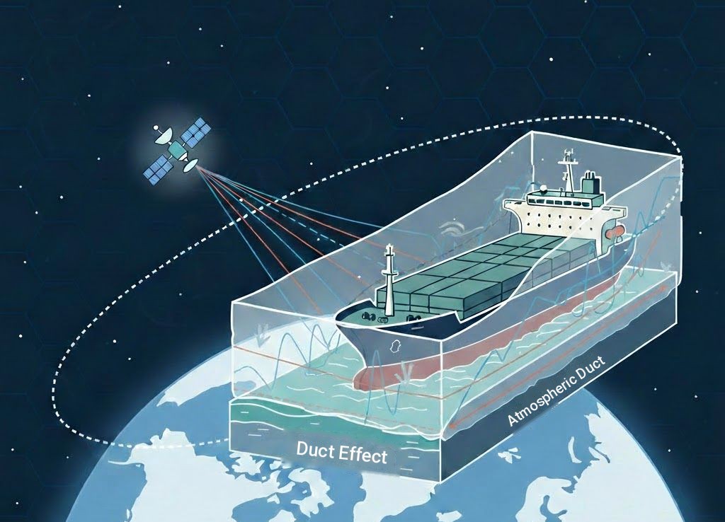
Over the sea, air layers with different temperature and humidity can trap the signal in a channel between the water surface and the atmosphere. This effect is called atmospheric ducting.
When a duct forms, the signal can travel far beyond its normal range, to distances of more than 100 km.
However, this effect is temporary and should not be relied on when planning 4G/5G coverage at sea. As atmospheric conditions change, signal indicators such as RSRP and SINR fluctuate suddenly, and signals from distant cells can also cause interference.
Poynting XPOL (Cross-Polarization) Technology at Sea
The success of MIMO systems depends on the antenna elements receiving independent signals. In Poynting XPOL technology, two antenna elements are placed at 90° to each other.
The polarization and phase of a signal reflected off the sea surface change. A single-polarized antenna can lose a significant part of the signal during this change. In a cross-polarized design, a signal received weakly by one element is received more strongly by the other; this keeps the link alive during fades and keeps the two MIMO channels decorrelated.
When choosing an antenna for 4G/5G coverage at sea
- Omnidirectional antenna: since the boat constantly changes heading, use an antenna that needs no pointing.
- High mounting point: the higher the antenna, the farther the radio horizon.
- Short, low-loss cable: loss in a cable running up the mast reduces antenna gain.
- MIMO connection: all of the antenna's cables should be connected to the router.
- Resistance to marine conditions: choose a marine antenna suited to salt water, UV and vibration.
Frequently Asked Questions About 4G/5G Coverage at Sea
How far from shore does 4G/5G work at sea?
The upper limit of 4G/5G coverage at sea is set by the radio horizon. Between a ship antenna 12 m high and a base station 25 m above sea level, line of sight is about 35 km. If the base station is on a high hill, this distance increases. Actual coverage may fall short of this limit because of signal level and cell settings.
Why does the signal suddenly drop close to shore?
When the direct signal and the signal reflected off the sea surface meet at the antenna in opposite phase, they weaken each other. These deep fade points vary with distance, antenna height and frequency; as the boat moves, the signal recovers.
How much difference does mounting the antenna higher make?
Because range grows with the square root of height, the gain is not linear. With the base station at 25 m, raising the ship antenna from 3 m to 12 m extends line of sight from about 28 km to 35 km. As height increases the cable also gets longer, so cable loss must be considered as well.
Can a directional antenna be used on a boat?
A directional antenna is not practical on a boat under way; as the boat changes heading and rolls, the antenna drifts off the base station. That is why omnidirectional MIMO antennas are preferred at sea. A directional antenna can only be considered for stationary installations such as a moored boat or a pier.
What can be done when cellular coverage ends offshore?
No cellular connection is possible beyond the radio horizon. Satellite connectivity is used in these areas; for solutions that combine cellular and satellite links in a single router, see the Starlink integration page.
Let's choose the right marine antenna for your boat together.
Contact us for a solution that meets your 4G/5G coverage needs at sea. BağLAN is the official Poynting distributor for Turkey.